Romania took hold of my heart in 2015 and since then has consumed my mind and soul. As with any genuine commitment, my relationship with this beautiful, complex country has grown and deepened over time as I have learned of its many tragedies, as well as its many triumphs. I have surrendered myself to Romania. [...] As I continue my Romanian journey, I marvel over the resiliency and fortitude of the people. I am fortunate to have developed close relationships, familial in many ways, with many Romanians. And I am eternally grateful to have been granted a Fulbright and honored to become part of this amazing community.
Using Cold War Spy Satellite Images to Analyze Ecological Change

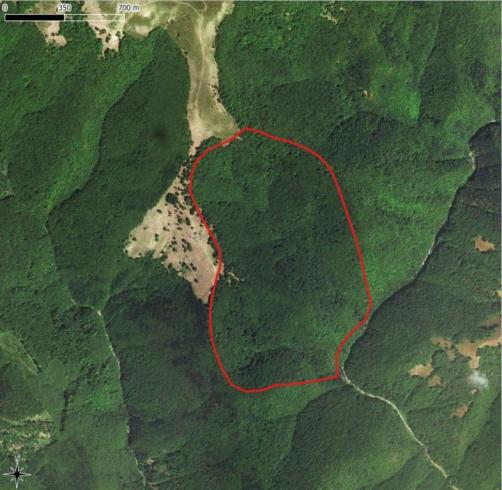
Credit: Mihai-Daniel Niță
Fulbright alumnus Dr. Mihai-Daniel Niță, Professor in the field of Forest Engineering at Transilvania University of Brașov, is featured in an article published by The New York Times about using Cold War spy satellite images to analyze historical ecological change. Dr. Niță’s research on this subject started during his 2016-2017 Fulbright grant at the University of Wisconsin-Madison.
Here is an excerpt from the NYT article:
“Not being able to see the forest for the trees isn’t just a colloquialism for Mihai Nita — it’s a professional disadvantage.
‘When I go into the forest, I can only see 100 meters around me,’ said Dr. Nita, a forest engineer at Transylvania University of Brasov, in Romania.
Dr. Nita’s research interest — the history of Eastern Europe’s forests — depends on a vaster, and more removed, vantage than eyes can provide.
‘You have to see what happened in the ’50s, or even a century ago,’ Dr. Nita said. ‘We needed an eye in the sky.’
To map a landscape’s history, foresters like Dr. Nita long depended on maps and traditional tree inventories that could be riddled with inaccuracies. But now they have a bird’s-eye view that is the product of a 20th century American spy program: the Corona project, which launched classified satellites in the 1960s and ’70s to peer down at the secrets of the Soviet military. In the process, these orbiting observers gathered approximately 850,000 images that were kept classified until the mid-1990s.”
Read the entire article at: https://www.nytimes.com/2021/01/05/science/corona-satellites-environment.html
More about Mihai-Daniel Niță’s work at: https://sites.google.com/view/mihaidanielnita/home


